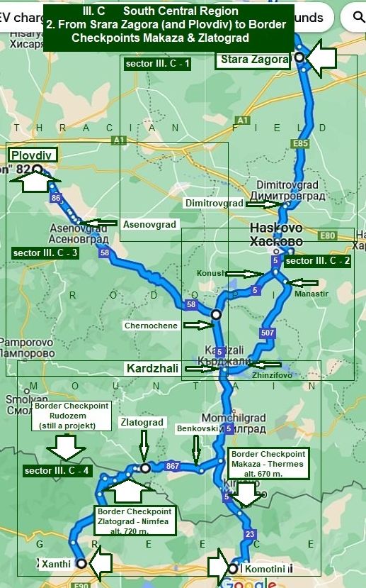
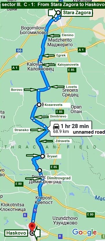
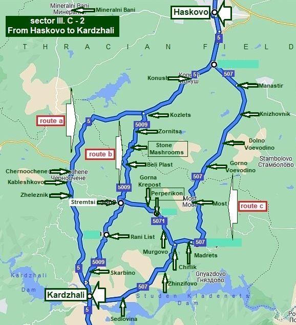
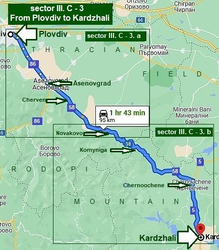
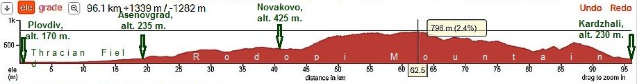
III. C    South - Central Region


CONTENT

               1. From Pazardzhik (and Belovo) to Border Checkpoint Ilinden - Exohi (roads N84, 842 & N19);

                     1. 1  From Pazardzhik to Avramovo Line Station;

                     1. 2  From Avramovo narrow-gage Line Station to Eleshnitsa;

                     1. 3  From Dobriniste (Eleshnitsa) to Border Checkpoint Ilinden - Exohi;

                     1. 4  Border Checkpoint Ilinden: Approach from Greece (from Prosotsani);


               2. From Stara Zagora (and Plovdiv) to border Checkpoints Makaza - Nimfea & Zlatograd - Nimfea;               

                2. 1   From Stara Zagora to Haskovo;

                2. 2   From Haskovo to Kardzhali;

                2. 3   From Plovdiv to Kardzhali;

                2. 4   From Kardzhali to Border Ckeckpoints Makaza - Thermes & Zlatograd - Thermes.


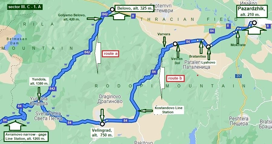
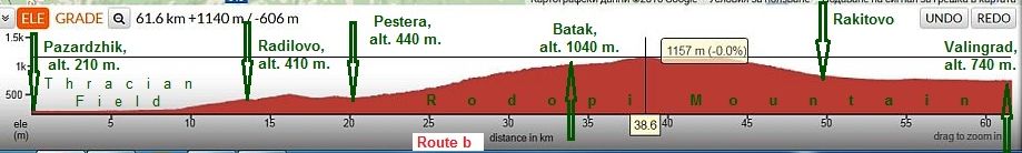
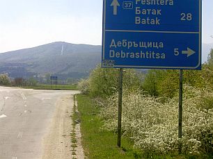
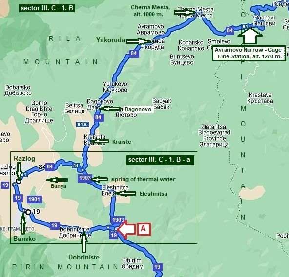
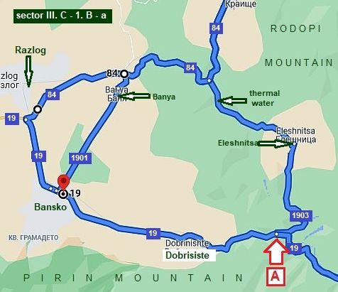
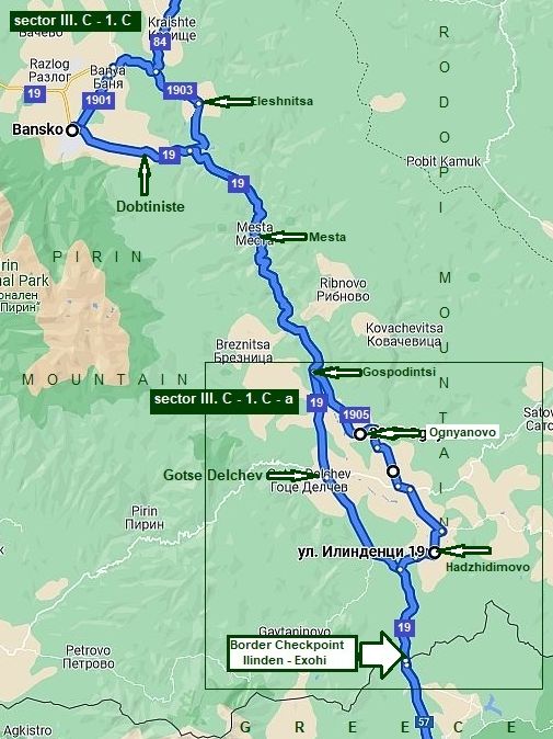
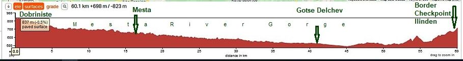
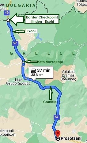
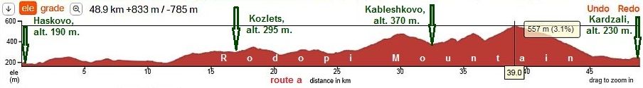
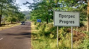
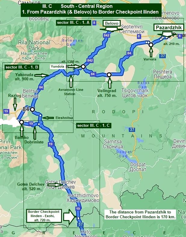
1. From Pazardzhik & Belovo to Border Checkpoint Ilinden

(Roads N 84, 842 and N19)


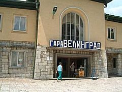
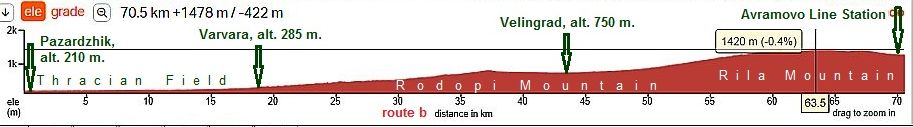
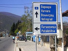
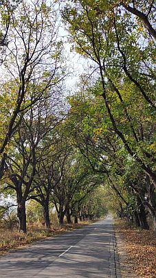
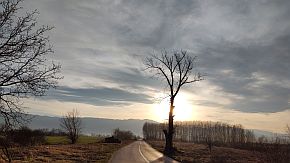
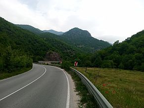
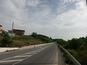
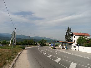
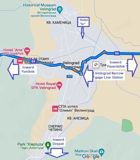
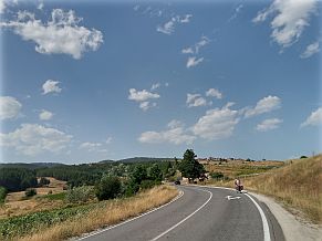
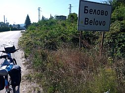
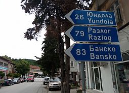
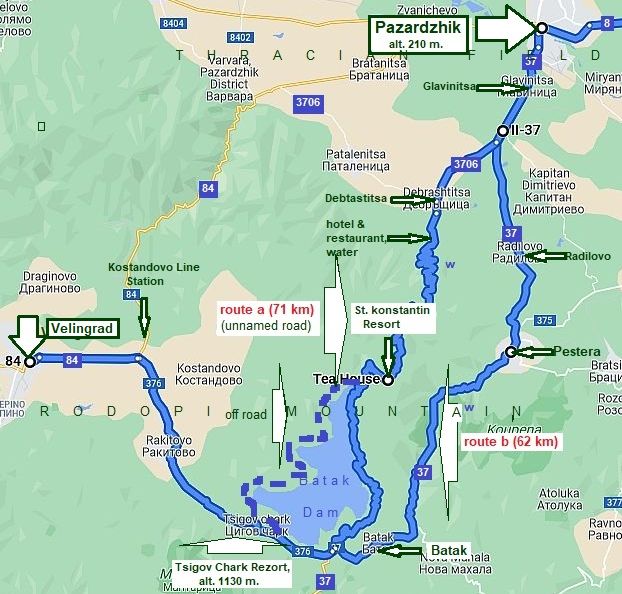
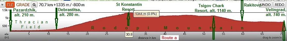
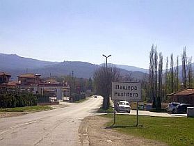
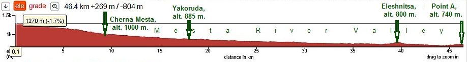
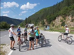
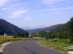
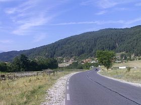
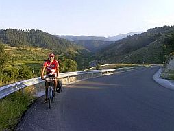
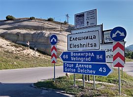
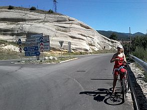
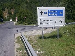
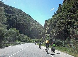
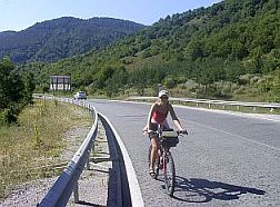
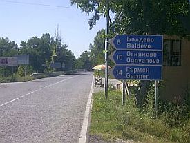
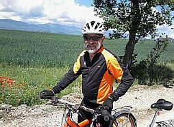
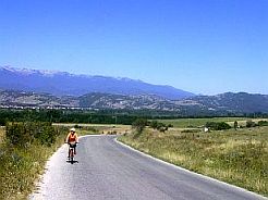
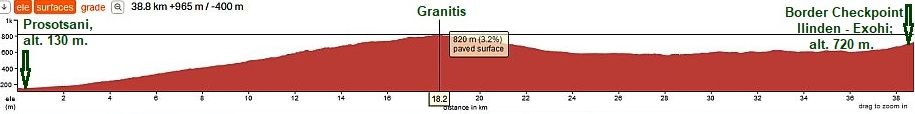
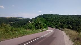
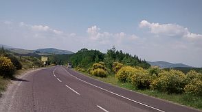
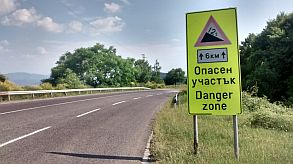
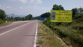
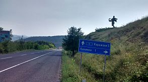
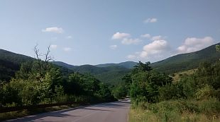
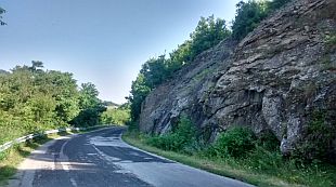
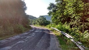
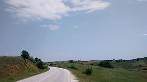
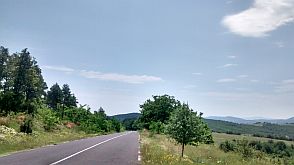
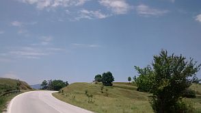
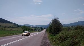
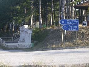
Content:

     1. 1  From Pazardzhik to Avramovo Line Station;

      1. 2  From Avramovo narrow-gage

      Line Station to Eleshnitsa;

      1. 3  From Dobriniste (Eleshnitsa) to

      Border Checkpoint Ilinden;

      1. 4  Border Checkpoint Ilinden:

      Approach from Greece from Prosotsani;

      It can be said, the best way to leave Bulgaria toward Greece by bicycle is this route (the food, water and overnight accommodations along this route are not a problem). No intensive traffic here, the countryside is one of the best in BG.

       For the route from Sofia to Belovo to Pazardzhik look into:

Chapter VI.

D. From Sofia to Plovdiv and Edirne (in Turkey)

      The route include Velingrad: it is very known spa centre - a lot of hotels& and swimming pools of thermal water are available there. A nice places to relax for an afternoon and night here are Bansko, Dobriniste and Ognyanov

(there will be details about these places).

      The route from Pazardzhik to Border Checkpoint Makaza is:

      From Pazardzhik to Lyahovo to Vetren Dol to Varvara to Velingrad to Yundola to Avramovo to Yakoruda (road N84) – Eleshnitsa to Gotse Delchev to Border Checkpoint Ilinden (road N19).


Some initial tips having in mind when explore this route:

      A. Pazardjik as a base point to enter in Rodopi Mountain toward border checkpoint Makaza.

      B. Varvara as a base point to enter in Rodopi Mountain toward border checkpoint Makaza.

      C. The narrow - gage train: from Septemvri to Dobriniste.


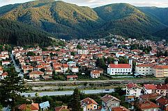
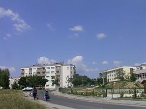
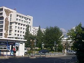
A. Pazardzhik (Pazardjik)

as a base point to enter in Rodopi Mountain toward border checkpoint Makaza.


      Pazardjik is very appropriate to be regarded as an initial/end point, when explore just this destination.


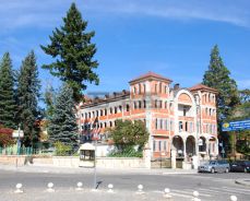
      It is not as big as Plovdiv. Most importantly, the traffic in it also is not as intensive as in Plovdiv. It is easy to orientate in it, nice hotels and restaurants in the area are at acceptable prices.

      In the link below more information concerning this town is available, I will not write about it here.

      http://en.wikipedia.org/wiki/Pazardzhik

http://www.guide-bulgaria.com/SC/pazardjik/pazardjik/pazardjik


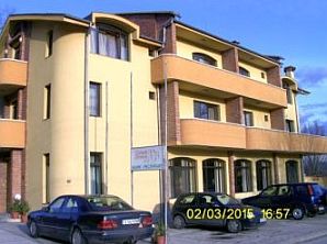
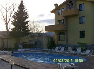
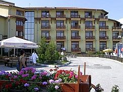
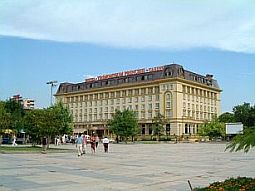
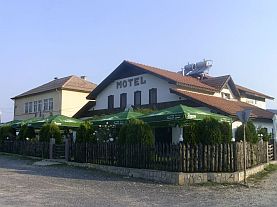
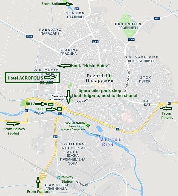
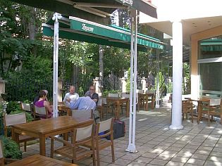
      For accommodations in Pazardzhik, I would recommend the Hotel Acropolis:

http://acropolispz.com/index_eng.htm

Pazardjik, Boul. „Hristo Botev“ 17, tel.: 034/45 10 45; cell tel: 0898 662 702,

e-mail: acropolispz@abv.bg     


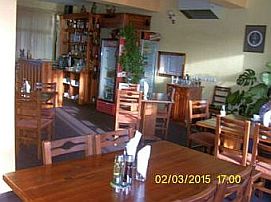
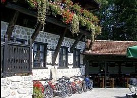
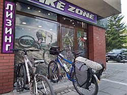
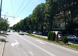
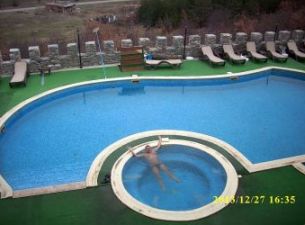
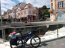
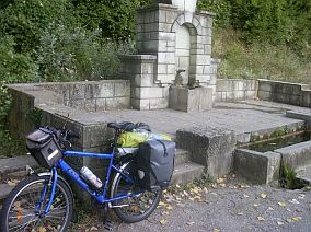
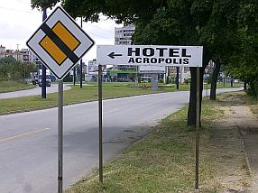
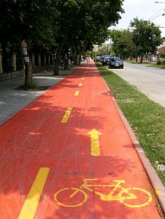
      Everywhere in the city there are a lot of labels which will lead you to the hotel, you easy will recognize the place seeing the red bicycle lane in front of it.

      It would be nice to stay and relax here for a night, because:

       - It is very easy to find;

-                - The hotel can be recognized easily by the new red bicycle lane just in front of it the right side of the street going to North (the photos below);

-               - The hotel is clean, the rooms are air conditioned, which is important in this town, where summer temperatures often are more than 40 deg C;

            - Opinions of the hotel guests are very nice;

-                - The hotel restaurant offers nice dishes, the staff speak very good  English;

             - The hotel has good Wi Fi;

-                - There is easy access to a free room for bicycle and pannier storage.

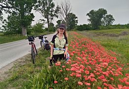
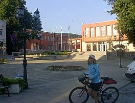
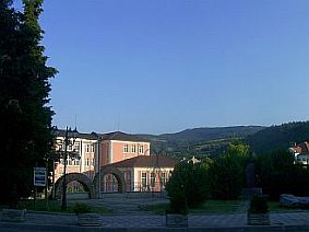
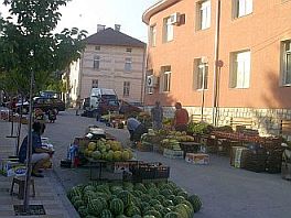
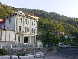
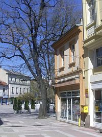
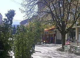
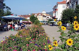
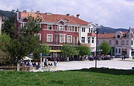
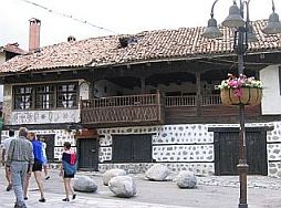
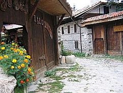
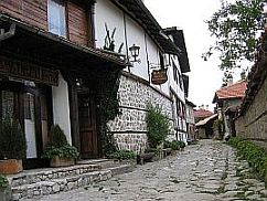
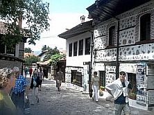
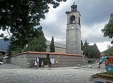
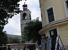
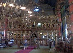
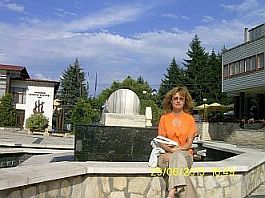
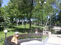
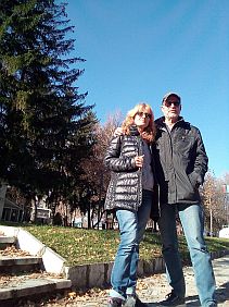
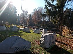
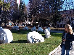
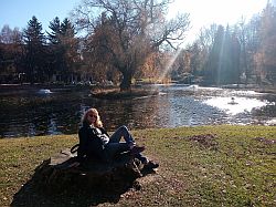
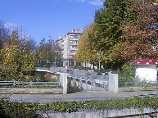
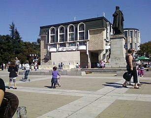
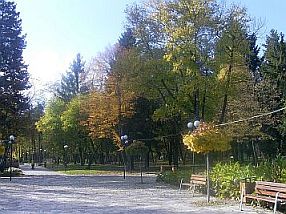
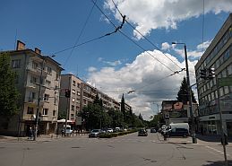
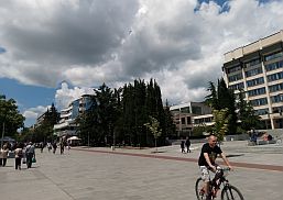
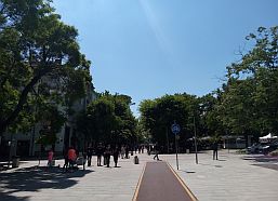
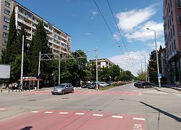
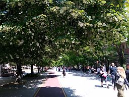
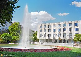
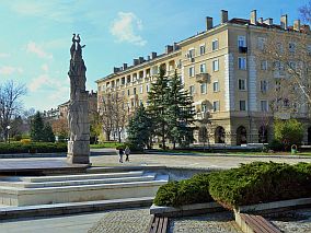
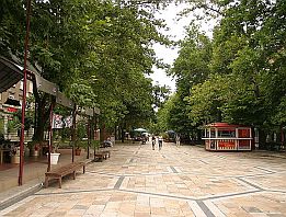
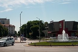
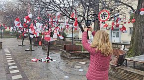
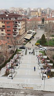
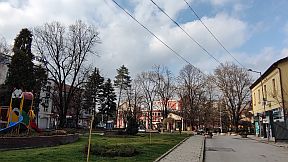
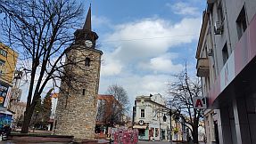
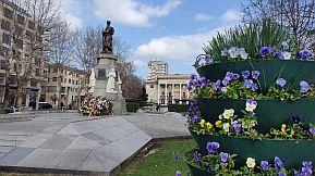
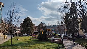
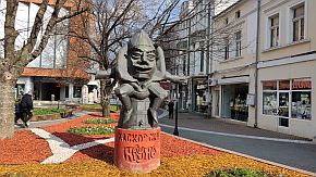
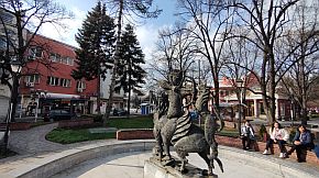
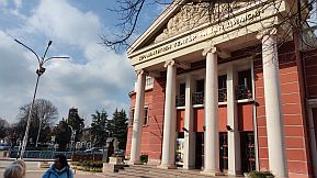
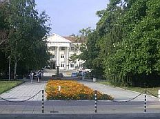
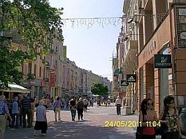
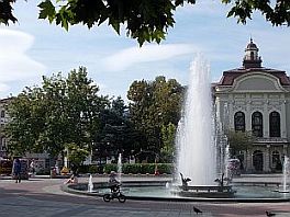
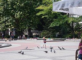
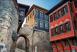
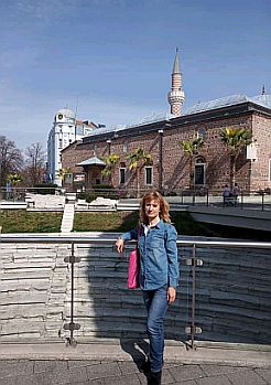
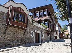
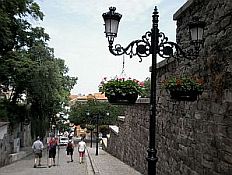
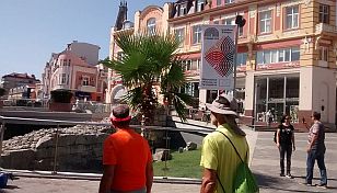
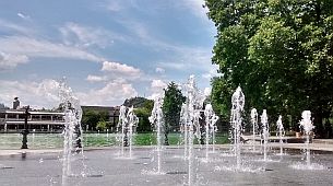
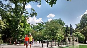
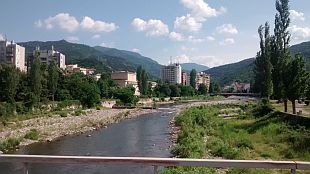
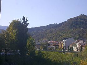
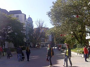
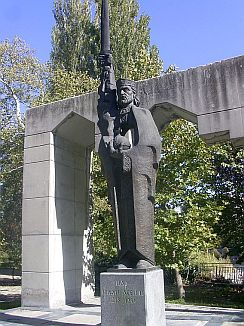
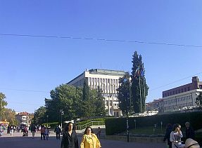
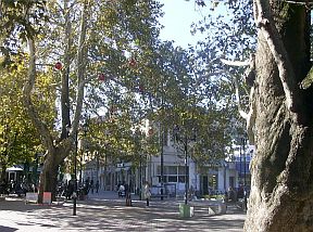
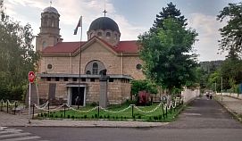
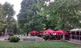
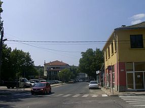
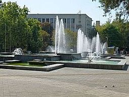
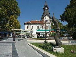
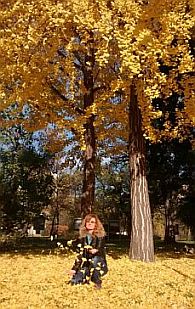
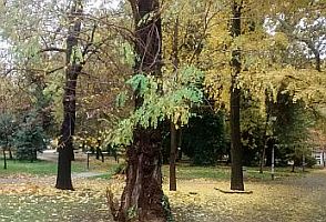
Several photos of Pazardzhik and its town garden.


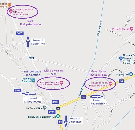
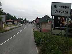
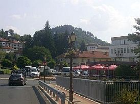
B. Varvara (or Vetren Dol)


as a base point to enter Rodopi Mountain toward border checkpoint Makaza.


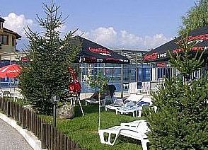
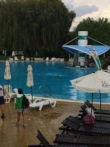
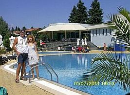
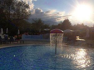
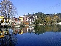
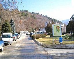
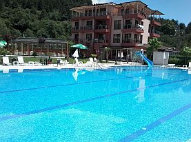
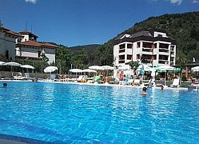
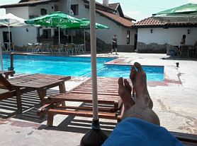
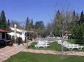
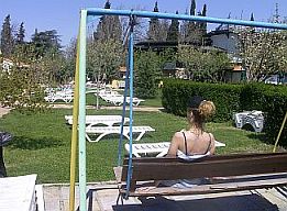
     Varvara is even a better place to be used as a base point when enteribg in Rodopi Mountains. In Varvara there is a nice motel and swimming pool of mineral water. On weekends in the summer (June - August) this area is very crowded with tourists and room reservations will be needed Friday & Saturday nights in the motel.


Some information for Varvara and Vetren Dol:


http://www.guide-bulgaria.com/SC/pazardjik/septemvri/varvara


http://www.guide-bulgaria.com/SC/pazardjik/septemvri/vetren_dol


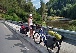
There are another possibilities for overnight accommodation in Varvara or Vetren Dol as well.

http://www.guide-bulgaria.com/SC/pazardjik/septemvri/vetren_dol
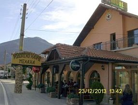
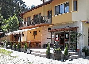
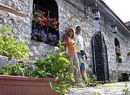
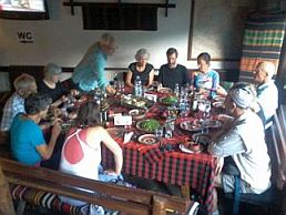
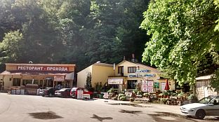
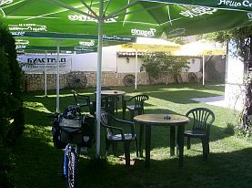
      The motel on the left, "Ðîäîïñêî õàí÷å" (Rodopsko Hanche) in Varvara has a nice restaurant and small swimming pool. I recommend it.

      In the photo on the right is a private home-hotel, "Ðàäîâàòà êúùà" (Radovata Kasta) in Vetren Dol.


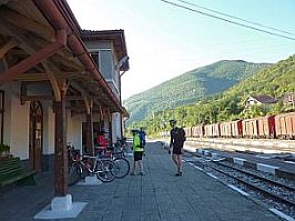
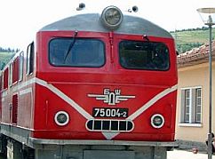
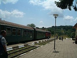
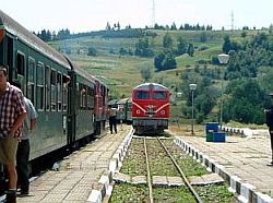
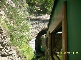
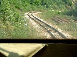
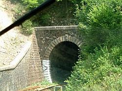
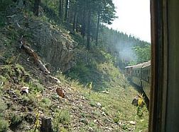
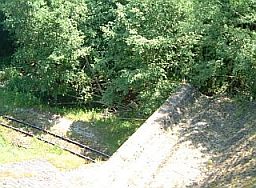
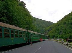
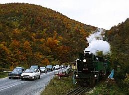
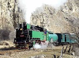
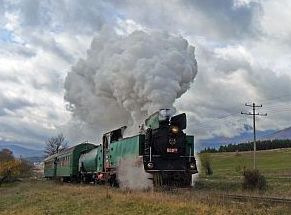
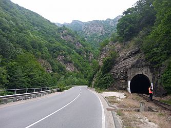
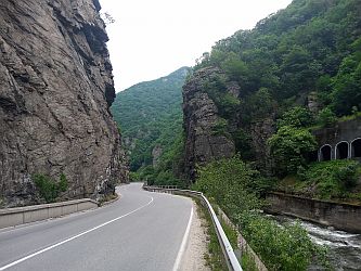
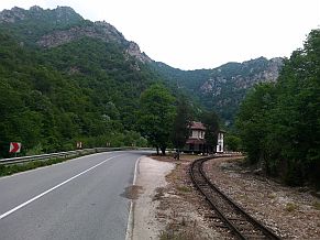
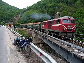
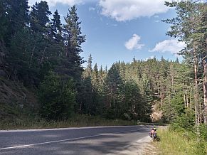
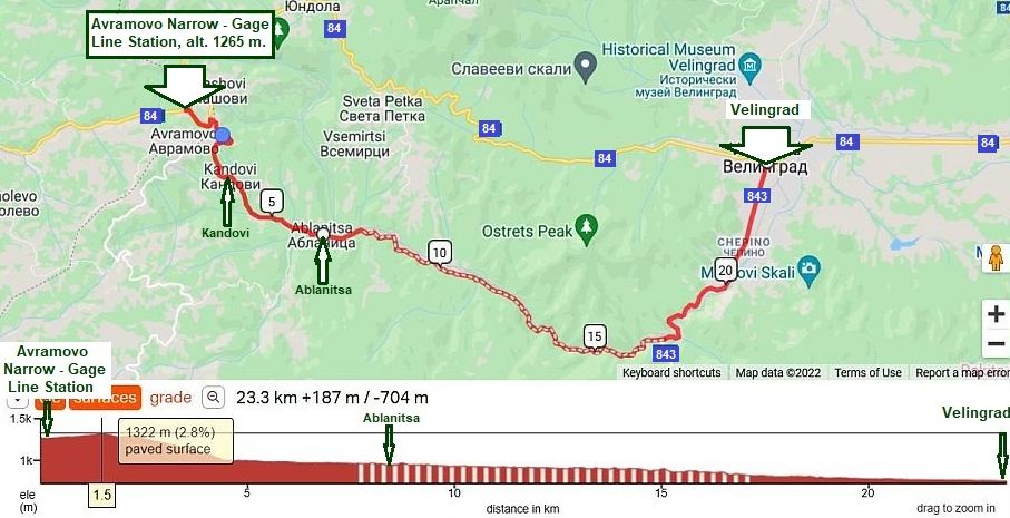
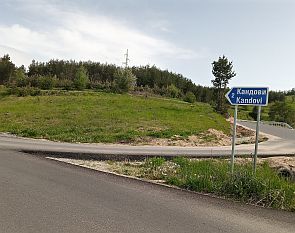
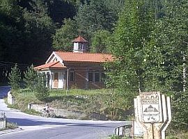
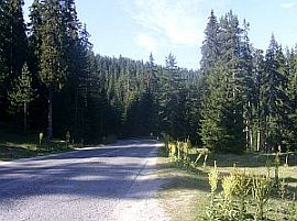
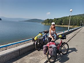
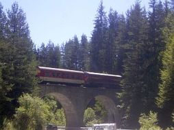
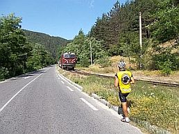
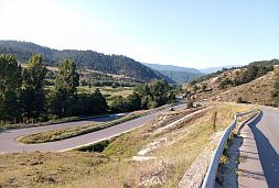
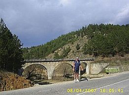
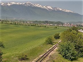
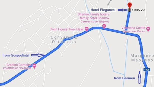
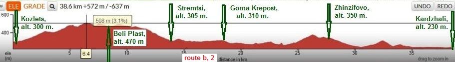
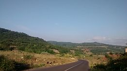
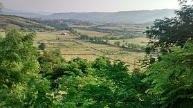
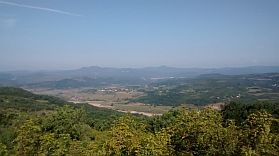
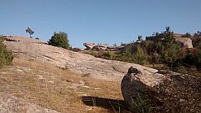
C. The narrow-gage train Septemvri - Dobriniste

As the traffic on the road N 84 from Varvara to Velingrad is intensive,  an appropriate way to enter in Rodopi Mountain is the narrow - gage train serving the line from Septemvri to Dobriniste. The red line on the map below shows places where the train line is not next to the road.

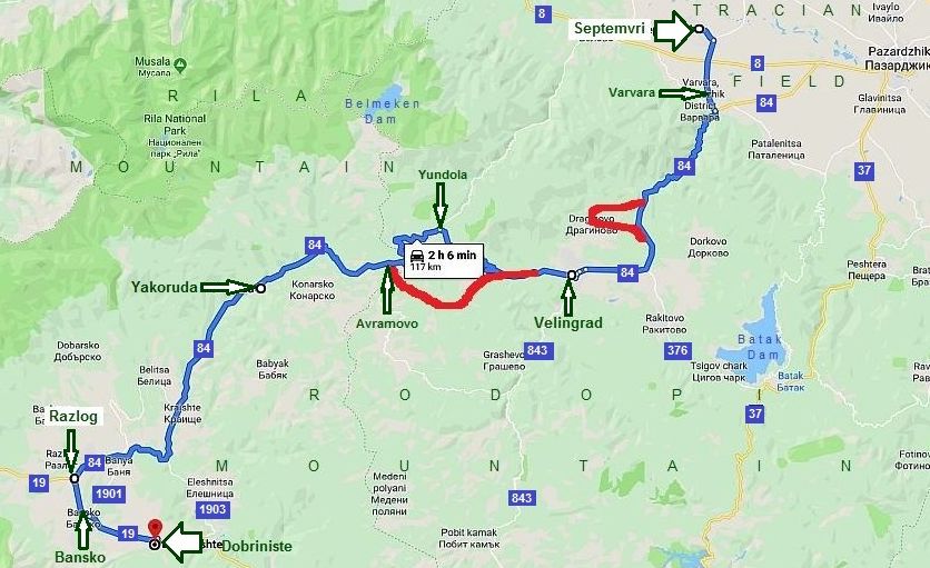
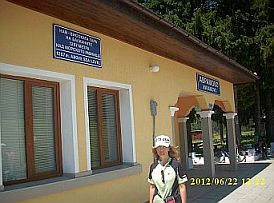
       More information concerning this amazing train can be seen here:

http://en.wikipedia.org/wiki/Septemvri

Dobrinishte_narrow_gauge_line


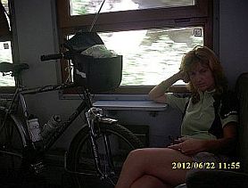
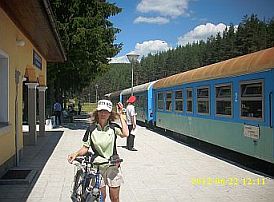
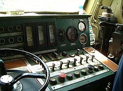
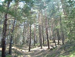
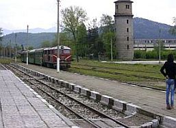
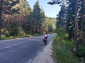
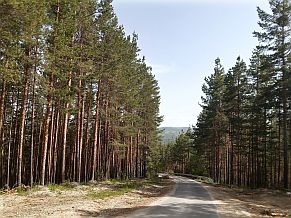
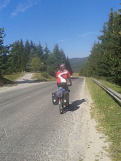
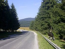
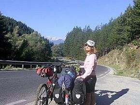
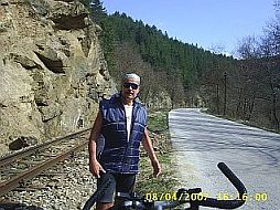
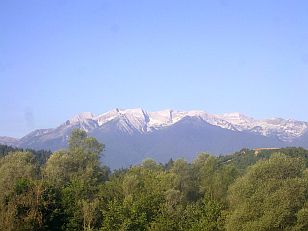
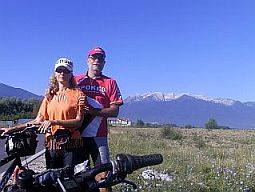
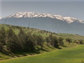
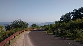
      A narrow gauge train can be taken on September (usually at 9 am). My suggestion is to catch the train in Varvara (at 8.46 am). Either of these two places can also be used as an initial point to explore the Rodopi mountains. There are several reasons to use this amazing train when you begin exploring Rodopi mountains:

  - I think there few trains in the world this memorable. The speed of the train is 25 – 30 km/hours, the scenery of the area it is going is marvelous as it can be seen from the photos below; Each year I travel by this train at least once;

  - It is not a problem taking your bicycle on this train. If there are more than 4 bicyclists in your group use different carts to load baggage. A ticket for the bike is 1 EURO;


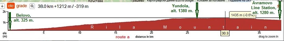
  - There is traffic from Varvara to Velingrad, which is not severe. It would be better on this road segment to travel by train;

  - Some elevation gains can be avoided. Varvara is at an elevation of 270 m., Velingrad is at an elevation of 750 m.. The highest point is at Avramovo line station, at almost 1300 m. My suggestion to tourists having a restricted time for touring is to take on the train to in the mountain. It will save some time which can be used later to visit more exciting places in the mountain;

  - Depending of the route you have decided on in Rodopi mountain, you can get off the train either at the Velingrad or Avramovo train stations;

  - The train can be used also for a route to Rila Mountain (see the Chapter for routes in Rila mountain);

  - In the opposite direction it would be unnecessary to travel by the train. The pedaling down the mountain along the line is very pleasant.

The train station in Varvara. Inside the cart - no problem to load your bicycle in it. The diesel engine - there are such engines made in Romania and former East Germany. At work since 1963.
Avramovo Line Station is the highest on Balkans, alt.1267. There are a lot of tunnels along the line. Inside the engine - some time I arrange tourists to travel inside it.
The visibility in the engine is much better than in the cart, but it is not easy to arrange to travel in it.
In the mountain there are several serpentines of the line.  Velingrad Line Station.
Old steam engines can be seen in Bansko Line Station. I am afraid now these steam engines are not there. Rocks on the line after powering rain. Some time in the mountain it happens

There is one original steam engine still at work, it is used only when there is a group of tourists paying in advance for such a travelling; See the video - speaking in Germans:

https://www.youtube.com/watch?v=2JbJvinBQ8s                        https://www.youtube.com/watch?v=0N2FfKQjvtg


 Sector III. C - 1. A

1. 1  From Pazardzhik to Avramovo Line Station.

 Route b:   From Pazardzhik to Mokriste to Leahovo to Bratanitsa to Vetren Dol to Varvara to Velingrad to Kostandovo Line Station to Velingrad to Yundola to Avramovo Line Station.

     Beginning from Pazardzhik, follow the route I point on the map above - so you will avoid the traffic between Pazardzhik,  Zvanichevo and Bratanitsa (road N84).


From Pazardzhik to Mokriste to Lyahovo to Bratanitsa.

      Several photos for the countryside toward Vetren Dol, Bratanitsa, Lyahovo and Pazardzhik in different seasons.


The same area - from Vetren Dol toward Patalenitsa and Lyahovo - photos were taken in the best November 2022.
February 2024
     The road segment from Varvara to Kostandovo Line Station is a beautiful gorge, unfortunately traffic here is quite intensive, especially weekends, the climbing up the mountain is not pleasant definitely. If you tour the   reverse direction, this road segment is nice for bicycling - I pedalled it several times, unfortunately my photos were taken in a dark day. Your speed will be almost the same as the one of the trucks.

      Several words for Velingrad: the city is a place with hotels and springs of thermal water. Information for Velingrad:

http://en.wikipedia.org/wiki/Velingrad

http://www.visitbulgarianet/en/velingrad/velingrad.html

https://bulgariatravel.org/en/town-of-velingrad/

      The city a known spa resort not only in Bulgaria. There are a lot of hotels of different quality.


      A nice place to stay for a night in is Hotel “Iv” (the 3 photos below). It can be found out easy, there is a nice small swimming pool of thermal water next to it, the place is clean, inexpensive, and the hotel restaurant offers nice meals. The staff is friendly, they have an experience with touring bicyclists:                

https://www.hotel-iv.com/en/

      The climbing from Velingrad toward Yundola (approx 18 km.) is relatively hard, have in mind it is a sunny place.         Water is available higher in the mountain near the crossroad toward St. Petka.

      Yundola is a little mountain resort placed just on the border between Rila and Rodopi Mountains, overnight accommodations are possible there:


https://bulgariatravel.org/yundola/

      The next several photos illustrate the countryside from Yundola toward Avramovo Line Station.


 ٭An Opportunity

      An excellent opportunity here, if you pedal in the reverse direction, is reaching Avramovo Narrow - Gage Line Station to take a road toward Kandovi to Ablanitsa to Velingrad. You will enter in a different world, they paved the road in 2020, although between Kandovi and Ablanitsa


the road in the forest is still gravel. Because there is several parallel gravel roads between them, do not be afraid, go only down the mountain, soon you will reach Ablanitsa. This opportunity is nice only when the weather is nice without raining.

      You will miss the climbing from Avramovo Line Station to Yundola as well.

Several photos of this area; needles to say it is perfect to set up your tent near the river.


Well, back now again to Sector III. C - 1. A

Route a: from Belovo  to Avramovo Line Station

      The stronger bicyclists can climb:

      From Belovo to Goliamo Belovo to Yundola Rezort (E842) to Avramovo Line Station.

      The route is 26 km. permanent climbing, the traffic


here is negligible. Bring some food with you. Beginning from Belovo, springs of drinkable water are available approximately after 4 km (just after leaving Golyamo Belovo), 9 km, 19 km and 23 km.

      This route is very nice in the reverse direction, I recommend it!

The climbing begin at Belovo. It is a little town, overnight accommodations are available in it.

http://www.guide-bulgaria.com/SC/pazardjik/belovo/belovo

Fore kilometers further is Golyamo Belovo - the last place you can find food.

Leaving Golyamo Belovo, you will see a nice water spring. From the other side next to the river is maybe the only nice place for camping in the wilderness all along the road to Yundola.

So, after 20 km.  hard pedaling up the mountain, you will be in Yundola.


٭Opportunities: I have to mention that the traffic along road 84 is intensive, next are opportunities to avoid it:

          - Route a: Bicyclists loving climbing should consider the next route:

      From Pazardjik to Glavinitsa to Debrastitsa  to St. Konstantin Resort to Batak Dam to Tsigov Chark Resort to Rakitovo to Velingrad.

      Is very pretty (photos below), there is hardly any traffic, and the climbing is hard;

      - Route b: It is also possible to pedal road N37:

      From Pazardzhik to Glavinitsa to Radilovo to Pestera (road 37) to Batak to Tsigov Chark Resort to Rakitovo (road 376) to Velingrad,

    The traffic is more intensive, especially from Pazardzhik to Pestera and this route is not as pretty as the previous one.


      Another very nice opportunity (I will not speak about it here) to reach border checkpoint Ilinden from Pazardzhik is given in:

   Chapter VII. Nice routes in mountains:

                    RODOPE Mountains

Route 2: From Pazardzhik to Velingrad to Dospat;

Route 3: From Pazardzhik to Batak to Dospat.

Route a (the map above)

Comparing with the route b the distance here is longer, the climbing is more as well, there is hardly any traffic, and the scenery is beautiful. I do recommend this route.

      Two kilometers above Debrastica there is a nice relaxing place. A hotel, restaurant, and drinkable water are available there. Four km up the mountain there is more of the same - all that I have pointed on the map Sector VII. 3. 1 above. The climbing here is not as easy, but it will be in a wooded and shade area.

      St. Konstantin Resort is located at the highest point of this route. Overnight accommodation is possible in it, restaurant is available as well. Because of there only one hotel is available, in the weekends problems with


the accommodation are possible (Friday and Saturday evenings).  If you need overnight accommodation, you can go further toward Tsigov Chark Resort.

https://bulgariatravel.org/batak-dam-resort-town-of-batak/

An especially scenic area is down toward Batak Dam.

      The dam is surrounded with a gravel road in this beautiful area. Pedaling the other side of the dam is a little


tedious, but there are nice spots for wild camping and places to enter and swim in the reservoir.

https://bulgariatravel.org/batak-dam-resort-town-of-batak/

The same place, the second half of July, '22.

      The next three photos are the area from Rakitovo toward Velingrad. And I can not forget a night we spent just before Rakitovo - August '21, when I was forgotten the

  tent frame . . . we had to sleep beneath the sky and counted the stars all the night . . . Fortunately this night mosquitoes were not active . . .

Route b

From Pazardzhik to Glavinitsa to Radilovo to Pestera (road 37) to Batak to Tsigov Chark Resort to Rakitovo (road 376) to Velingrad,

Here the climbing is not as hard as route a. The traffic from Pazardzhik to Pestera can be busy. I would not say it is a dangerous road. Overnight accommodations are possible in Pestera.

Overnight accommodations are possible in Pestera. Information and several photos from the little city.

http://www.guide-bulgaria.com/SC/pazardjik/peshtera/peshtera                                           https://en.wikipedia.org/wiki/Peshtera

Next to the town are remains of mediaeval fortress, a little museum is available there - you can try some mediaeval weapons in it. 

      Further up in the mountain is Batak. The traffic here is much less, the road is going up in the mountain via scenic gorge. Information for Batak:

https://en.wikipedia.org/wiki/Batak,_Bulgaria

http://www.visitbulgaria.net/en/batak/batak.html

      The history of this little town was quite unhappy in connection with uprising April 1876. Information for it can be seen here, my suggestion to more sensitive persons is to miss this information.

https://en.wikipedia.org/wiki/April_Uprising

https://en.wikipedia.org/wiki/Batak_massacre

https://bulgariatravel.org/history-museum-town-of-batak/

      The only photo I have from this region is in right - relax near the beautiful river up the mountain.

      Seven kilometers up in the mountain is Batak Dam, Tsigov Chark resort is placed near the reservoir.  In the little Resort Tsigov Chark  (at Batak Dam) there is a restaurant, hotel, little shops, it is a place to relax.


Information for the little resort and several photos: 


https://bulgariatravel.org/batak-dam-resort-town-of-batak/

http://www.visitbulgaria.net/en/tsigov_chark/tsigov_chark.html


Sector III. C - 1. B


1. 2  From Avramovo narrow-gage Line Station to Eleshnitsa and a little further: (the crossroad of roads N19 & N1903 - point A)


      The next segment is one of my favorite ones all over BG. I always make time for a stay here. A perfect area (photos below) for camping. No problem finding water and food here.


      The road has just been resurfaced and is in very good condition.


       Sometime on weekends (especially Sunday afternoons) the traffic is heavy.


      Overnight accommodations in Yakoruda are available. My suggestion is to go toward Bansko or Dobriniste. Information about Yakoruda:


http://www.visitbulgaria.net/en/yakoruda/

yakoruda.html

      Beginning at the Avramovo Line Station, the road follows a very pleasant descent. The road runs parallel to the Mesta River.

        Pedaling in the reverse direction is not difficult at all. The most scenic road segment is between Avramovo Line Station and Cherna Mesta.

A bigger settlement here is Yakoruda, overnight accommodations are available. Information about Yakoruda and several photos:          http://www.visitbulgaria.net/en/yakoruda/yakoruda.html

Toward Eleshnitsa.  Along the road there are a lot of fresh water springs for your enjoyment.

Several kilometers after the crossroad toward Eleshnitsa there is a spring of thermal water. (I point this spot on the map above).

      The place is easy to recognize seeing a rope bridge over the Mesta River, left, pedaling down to the stream. You will notice a little chapel. Nobody will stop you from setting up your tent next to it. You can enjoy the little pool of thermal water there (36 deg C). Usually there is nobody else there.


     My FB friend, Dogaru Armin,  followed my instructions and May 2018 spent a nice night just here - the photo in right:


      "And your site is also very helpful. With a lot of useful information to plan a trip. Boris, I wanted to thank you. I followed your advice and I spent a night at Eleshnitsa. As you say on your site, I put my tent near the small chapel. The water there is amazing. So hot. Thank you and have a nice day".

    In the village of Eleshnitsa you can find another very nice thermal swimming pool. The facilities there are old and does not look nice. But, the place in fact is very clean, the water is beautiful.


Overnight accommodations are available there, too. The natural scenery in the area of Eleshnitsa is very scenic.

      Information for Eleshnitsa can be found here:

http://www.guide-bulgaria.com/SW/blagoevgrad/razlog/eleshnitsa

The last photo above shows the Point A in the map of  Sector VII. 1 - B; You will see this disposition coming from south.

٭Opportunities in the region


Sector III. C - 1. B - a

      Here I will increase the scale a little showing an opportunity in the region.

      If you have a time  extend your route a little and visit Banya, Bansko, Dobriniste, or Razlog.

      From Dobriniste or Bansko there are nice hiking trails in the Pirin mountain which I have mentioned here:


Capter VII.  Routes in Mountains,

PIRIN Mountains


The next three photos illustrate the road toward Banya

      Banya is a nice place for an overnight stay, with many hotel choices. It is also a place with thermal water.      But I would suggest you to go further toward Bansko and Dobriniste.


Information for Banya:

http://www.guide-bulgaria.com/SW/blagoevgrad/razlog/banya


      Pedaling from Banya toward Bansko you will enjoy a really nice view of the Pirin Mountains. You will see the highest peak, the view is extremely impressive the months of May - June, when the higher parts of the mountain are still covered by snow.


      Bansko (next photos) is a winter resort. Each winter thousands of tourists (most of them are coming from GB) spend their vacations here. More information about Bansko can be seen here:

http://www.bulgariaski.com/bansko/

http://www.banskoski.com/en

https://bulgariatravel.org/en/bansko/

      In the summer the resort is not crowded with tourists, except of several days on August, when there is a jazz festival lasting several days. Check ahead to find out exact dates. There are a lot of hotels you can stay for a night.


      I can say that people here are masters of cooking meat meals in restaurants. Be aware that this area is more expensive than the next one I will describe at Dobriniste: 7 – 8 kilometers east from Bansko.

      The view toward the mountain on a full moon night is amazing. It must be seen. Next several photos are taken in the old part of Bansko.

      For the possibilities to explore Pirin Mountain from Bansko, please look in:

Capter VII.  Nice Routes in Mountains,

PIRIN Mountains


      Dobriniste is 6 kilometers east from Bansko. Again, it is overcrowded with tourists in winter. It is my opinion that you should choose Dobriniste over Bansko to visit. Dobriniste is less inexpensive, especially restaurants. People here also are masters of preparing meal dishes.

https://www.visitbulgaria.net/en/dobrinishte/dobrinishte.html

https://bulgariatravel.org/en/dobrinishte/

      Here are reasons I love there place: There is very nice swimming pool of thermal water (I have never missed to stay there for an afternoon). There is a chair type lift to the higher part of Pirin Mountain. There are very nice local type restaurants offering very tasty meat dishes (look for "Makedonska Krachma". Overnight accommodations are not a problem and prices are quite reasonable. so I do not miss to stay here for a day or two I am touring.

Information on exploring Pirin Mountain from Dobriniste can be found here:

Capter VII.  Nice Routes in Mountains, PIRIN Mountains


Information for Razlog can be seen here:

https://www.visitbulgaria.net/en/razlog/razlog.html

      The next three photos show the road toward Razlog.


The view toward Pirin Mountain is extremely impressive, although photos taken by my cell phone do not do the scenery justice.

The last time I pedaled here my speed shifter broke, fortunately in the center of the town there was a bike shop. I changed it without any problems. Several photos from Razlog.

Near Razlog can be found quite a few hotels. In the summer, you should have no problem finding vacancies.


Sector III. C - 1. C


1. 3   From Dobriniste (Eleshnitsa) to Border Checkpoint Ilinden


       Here is the long and scenic Gorge of the Mesta River:


      From Dobriniste (or Eleshnitsa) to Mesta to Gospodintsi to Gotse Delchev  to Border Checkpoint Ilinden.


      On your right side is Pirin Mountain, on your left is Rodopi Mountain. The road is an international road, wide and will not have a lot of traffic. The road follows the long and scenic Mesta River Gorge. The Pedaling here is a real pleasure in the both directions.


      There is a little restaurant located about half way through the road. You will also notice a lot of water fountains along the route as well.

Next photos are the countryside down the stream of Mesta River.


٭Opportunities in the region

OGNYANOVO


sector III. C - 1.C - a


      When either entering Bulgaria from Greece, or leaving Bulgaria, bicycling along road N19, I encourage a visit to Ognyanovo .


      Because of the thermal springs in the region, Ognyanovo has become a popular place to vacation. Over the last few years, weekends and the month of August, more tourists are attracted the small resort.

        Information for Ognyanovo:


https://bulgariatravel.org/ognyanovski-mineralni-bani/

https://www.visitbulgaria.net/en/ognyanovo/ognyanovo.html


      The next several photos show the approach toward Ognyanovo from Gospodintsi on road N1905.

Approaching to Garmen and Ognyanovo from Gotse Delchev can be seen remains of the ancient Roman fortress Nikopolis ad Nestrum.                  https://en.wikipedia.org/wiki/Nicopolis_ad_Nestum


      I can recommend a very nice place to stay, the hotel Elegance. The prices and quality of the hotel is quite affordable. The hotel consists two buildings - a new and older one, both are in very good conditions. Unfortunately the site is in Bulgarian:


http://www.comunicatorbg.com/elegance.html


      You can see information concerning prices, rooms, restaurant, swimming pool, SPA information on their website.


      It is very easy to find out this hotel. Simply look for signs on the street poles:

  - Coming from North, the hotel is in the opposite end of the village;

  - Coming from South, the hotel is to right, immediately after the bridge entering Ognyanovo.


      I will mention only that it is a clean place having a nice restaurant and a swimming pool of beautiful thermal water. Guiding bicyclists, I always recommend them to stay here for a night, and they will not be disappointed.


Overnight accommodations are possible in Gotse Delchev, too. Information about Gotse Delchev:

http://www.visitbulgaria.net/en/gotse_delchev/gotse_delchev.html


1.4   Border Checkpoint Ilinden: Approach from Greece


      For bicyclists coming from Greece:


Prosotsani - from Drama, or Serres, or Thessalonici.


      Just after Prosotsani (alt. 130 m.) it begins a long climbing (just after the crest you see on the photo) up to Granitis (alt. 815 m). It is a very sunny and dry place - the photos on the right show this very well. Plan on pedaling this section in the morning, and carry water.

      Hotels, restaurants, and water can be found out in Granitis, located on the highest point of the road.


      2. From Haskovo (Plovdiv) to Chernoochene to Kardzhali


      What about Point 2 I can say the roads are in very nice conditions and all that area is very nice countryside.


      Unfortunately the last several years the traffic on the roads E 85 and N5 toward border checkpoint Makaza - Thermes was increased considerably especially in the vacancy months July and August, when tourists from Romania are visiting the Aegean. So, in my next description I will give a lot of opportunities to avoid these roads.


      If you pedal the back direction, have in mind that immediately north after Kardzhali (toward Chernoochene) there is 7 - 8 kilometers long hill (road 5), the slope here is 12%, it is quite tough to pedal it in the hot summer afternoons.


Content of the point:


2. 1   From Stara Zagora to Haskovo;

2. 2   From Haskovo to Kardzhali;

2. 3   From Plovdiv to Kardzhali.

2. 4   From Kardzhali to Border Ckeckpoints

          Makaza - Thermes & Zlatograd - Nimfea


     For a comparison, next are the road profile charts for routes:


     - From Haskovo toward border checkpoint Makaza - Thermes to Komotini (in Greece), and


     - From Haskovo to border checkpoint Zlatograd - Nimfea to Xanti (in Greece)

Road profile from Haskovo to border checkpoint Makaza:

Road profile  from border checkpoint Makaza to Komotini (in Greece):

Road profile from Haskovo to border checkpoint Zlatograd:

Road profile  from border checkpoint Zlatograd to Xanthi (in Greece):


Sector III. C - 1


2. 1   From Stara Zagora to Haskovo


      The most important  to avoid road E85, because of the heavy traffic.


      From Stara Zagora to Elenino to Egrek to Kaloyanovets to Lovets to Borovo to Kozarevets to Dimitrievo to Dtransko to Zdravets to Bryast to Dimitrovgrad yo Haskovo.


      The route here is: the road is in the Thracian Field away from bigger towns. Here roads are "III and IV road class" according to our notification, so roads here are not numbered.


      You will travel through several little villages. Food is available in Kaloyanovets. There is very little traffic here.  You will see a few cars and some agricultural machines. The signing of the road is limited. A GPS device would work here.


      The road profile chart shows that the route is easy for pedaling in the both directions. I do recommend this route.


     The biggest city in this part of the country is Stara Zagora. Overnight accommodation in Stara Zagora is not a problem.


Links with information about the city is here:

https://bulgariatravel.org/en/stara-zagora/

https://en.wikipedia.org/wiki/Stara_Zagora

      The next pictures are taken on the 30th of March 2022. It was the last day of my 10 day beautiful tour in     

very nice early spring. Elenovo is left from the road. it is still a suburb of Stara Zagora. Food is available here.

The road after Borovo is in not nice condition, but for pedalling is very nice.
The entire area is very nice to camp in the wilderness.  
Next several photos illustrate the same area - from Stara Zagora to Borovo, two months later.

Next town is Dimitrovgrad. A little information for it:

http://www.visitbulgaria.net/en/dimitrovgrad/dimitrovgrad.html


       Overnight accommodation here is not a problem. The traffic from Dimitrovgrad toward Haskovo is more intensive, but the road here is wide enough, I think it is save to pedal here.


Sector III. C - 2

2. 2   From Haskovo to Kardzhali

      For the route from Haskovo to Kardzali I will suggest the next three routes:

- route a:

      On the main road N5: the distance from Haskovo to Kardzali is approx 50 km:

      From Haskovo to Konush to Kozlets to Chernoochene to Kableshkovo to Kardzali.

      As the traffic on the road N5 is intensive some days, you can follow some of the next two routes:

- route b:

      For this route further I will show 2 alternatives:

  - route b, 1: the first one is only the road 5009:

      From Haskovo to Konush to Kozlets (road N5) to Zornitsa to Beli Plast to Stremtsi to Rani List to Skarbino (road N5009) to Kardzhali;

  - route b, 2: the second one - including road 5071.

      From Haskovo to Konush to Kozlets (road N5) to Zornitsa to Beli Plast to Stremtsi (road N5009) to Gorna Krepost to Murgovo to Chiflik (road N5071) to Zhinzifovo to Sedlovina to Kardzhali (road N507) .

- route c : (road N507)

      From Haskovo to Manastir  to Gorno Voevodino  to Maslinovo to Chernyovtsi  to Madrets to Zhinzifovo to Sedlovina to Kardzali.

Haskovo is relatively big town, overnight accommodation is possible in it. Information for it can be seen here:

http://www.guide-bulgaria.com/SC/haskovo/haskovo/haskovo

On the map above I point a spot Mineralni Bani located 10 - 12 kilometers west from Haskovo, it is a nice local spa resort with very nice thermal water:

http://www.guide-bulgaria.com/SC/haskovo/mineralni_bani/mineralni_bani

Several photos of Haskovo

Sector III. C - 2,  route a:

It is the main road N5: from Haskovo to Kardzali: As a mountain area, the route includes a lot of ascending and descending.

From Haskovo to Konush to Kozlets to Chernoochene to Kableshkovo to Kardzali.

The road from Haskovo to Kozlets  is relatively easy for pedalling. Food is available in both villages Konush and Kozlets.

     The distance between Kozlets and Pchelarovo I travelled only by a car. The next several kilometers

  between Chernoochene and Kardzhali include three not long hills of 10 - 12 % slopes.

      If you travel in the reverse direction - from south to north, after Kardzali you will pedal up six very difficult kilometers. The hill can be quite tough to pedal it in the


hot summer afternoons.

Some days the traffic here is intensive, never mind the road is closed for trucks heavier than 3,5 metric tons.

Sector III. C - 2,  route b:

       To avoid the road N5 I will give two opportunities (I do not point it to the map above, but it is easy to be recognised):

- the first one is only the road 5009;

- the second one - including road 5071. 

            - route b, 1:

      From Haskovo to Kozlets to Beli Plast to Stremtsi to Rani List to Skarbino to Kardzhali (road 5009).

      After Kozlets you will pedal a road without any traffic. An interesting spot here on the highest point north from Beli Plast


is the place with the stone mushrooms near Beli Plast:      

https://bulgariatravel.org/kamenni-gabi-

stone-mushrooms-natural-landmark/

      Next to Stremtsi is placed a little vacancy village "Vili Perpereshka Reka"; water, restaurant and


overnight accommodation are available there:

http://www.visitbulgaria.net/en/kardjali/villas/perpershka

_river_villas.html

      - route b, 2: this route is little longer comparing with the previous one, but it is much more scenic:

     From Haskovo (road 5009) to Konush to Kozlets to Zornitsa to Beli Plast to Stremtsi (road 5071) to Gorna Krepost to Murgovo to Chiflik (road 507) to Zhinzifovo to Sedlovina to Kardzhali.

      If you pedal in the reverse direction, I would recommend this route to avoid the hard climbing north from Kardzhali.

      A place you can visit here (if you love rock remains)


is Perperikon. Information for it:

https://bulgariatravel.org/medieval-archaeological-complex-perperikon-town-of-kardzhali/

http://www.atlasobscura.com/places/perperikon

      Pictures from the megaliths in Perperikon:

Sector III. C - 2, route c:

      From Haskovo (roads 5, after 507) to Manastir  to Knizhovnik to Dolno Voevodino to Gorno Voevodino to Maslinovo to Most  to Madrets to Chiflik to Zhinzifovo to Sedlovina to Kardzali.

      It is the last opportunity I would suggest in this sector.

      The distance here is almost the same as of the other routes, but here there is not any traffic. Never mind that just after Haskovo you will see a sign directing heavier

  tracks to follow this road, you will not see here such a tracks. Especially after Manastir, you will be alone on the road.

Food and water supply here is not a problem. Several kilometers south from Manastir there are 2 restaurants near the road.

A lot of information for Kardzhali can be seen here:

http://www.visitbulgaria.net/en/kardjali/kardjali.html                 https://en.wikipedia.org/wiki/Kardzhali

Several photos from Kardzali.


Sector III. C - 3


2. 3    From Plovdiv to Kardzhali

      From Plovdiv (road 86) to Asenovgrad (road 58) to Cherven to Novakovo to Komuniga to Chernoochene  (road 5) to Kardzhali.


      This route is nice to enter in Rodopi Mountain starting from Plovdiv. The road is in a nice condition, pedaling is safe. You will find springs of drinkable water and food.


      The road profile chart shows that the pedaling is in the mountain area except several kilometers in Thracian Field between Plovdiv and Asenovgrad.


      For more detail description, I will part it in two sectors.

Sector III. C - 3. a

      The route in this sector is:

      From Plovdiv to Asenovgrad (road 86) to Cherven to Dolnoslav to Topolovo to Novakovo (road 58).

     The road segment from Plovdiv to Asenovgrad is still in Thracian Field. There can be heavy traffic on this road. The road has been recently resurfaced.  The road is wide enough and pedaling here is safe.

      The election gain to Novakovo is almost 300 m., over a short distance. There will be a steeper hill after Asenovgrad.

      The last time I pedaled this route was a June Sunday afternoon 2019, the traffic between Cherven and Asenovgrad was heavy.

      Plovdiv is a popular tourist destination in Bulgaria. So you may find the city has heavy traffic.

        Detail information for Plovdiv can be seen here:

https://en.wikipedia.org/wiki/Plovdiv


https://bulgariatravel.org/plovdiv-city/


https://bulgariatravel.org/en/plovdiv-city/


      On the map I have shown the way to cross the city of Plovdiv by the green dashed line in order to avoid the tunnel under the hill with the Ancient Amphitheatre on it, although it is not a problem to pedal it.

     I have pointed the walking area in the Plovdiv city (the next several pictures) beginning with the walking bridge on Maritsa River by the dashed green line – use it. (DO NOT PEDAL THERE !!!,  - it is forbidden, only walk !!!)


The next link is a map for the velo lanes in Plovdiv:

https://www.velo-plovdiv-tourist-map.truenorth.bg/


      The next link is a map for the velo lanes in Plovdiv:

https://www.velo-plovdiv-tourist-map.truenorth.bg/


The History Hill of the Old Town and the Ancient Amphitheatre on it.
      There can be a lot of traffic from Plovdiv to Asenovgrad. But, the road has been resurfaced, wide, and I think it is safe to pedal.

       The road toward Kardzhali in Asenovgrad is signed well, if you follow signs toward Kardzhali, you will not enter in the town center. Overnight accommodation in Asenovgrad is available.


Information for Asenovgrad:

https://en.wikipedia.org/wiki/Asenovgrad

http://www.visitbulgaria.net/en/assenovgrad/assenovgrad.html

      Several photos from Asenovgrad

    Above the town are remains of a mediaeval fortress:

https://bulgariatravel.org/asens-fortress-and

-the-city-of-asenovgrad/

     The church you see on the second photo is used as a

  label of exceptionally aromatic local type red wine named "Màâðóä" (Mavrud). Try it, you will not regret, you can find it almost everywhere for 3-4 EURO/bottle.

      Leaving Asenovgrad you will start climbing Rodopi Mountain. The first village after Asenovgrad is Cherven:

http://www.guide-bulgaria.com/SC/plovdiv/asenovgrad/cherven

  where a huge tree can be seen, the overnight accommodation is available here as well - there is a big hotel placed just near the road.
In the next villages food is available except Novakovo. The entire area after Asenovgrad is nice to camp in the wilderness.


Sector III. C - 3. b


      It is extremely pleasant mountain area. The climbing after Novakovo is not hard and if you are earlier there, you will climb on the shade.

      The route is: more intensive traffic is available on the road N5.

      From Novakovo to Komuniga to Chernoochene to Kableshkovo to Zheleznik to Kardzhali.

Eight - nine kilometers after Novakovo there is a restaurant and cool water, a nice spot to relax.

Several kilometers further (again 7 - 8 km, again there is a restaurant and water.
The country side toward Komuniga and the main road N5

      The main road N5 is with more intensive traffic, but it is wide enough and I think it is save. Unfortunately no any shade here and summer afternoons are a little tough for

  pedalling here. After Kableshkovo there two not so long hills, where the slope is 10 %.

      Just before Kardzhali there is a steep 7 - 8 km descending. The slope here is even 12 %.  If you pedal 

  the reverse direction, the hill can be quite tough to pedal it in the hot summer afternoons.

Sector III. C - 4

2. 4  From Kardzhali to Border Checkpoint Makaza - Thermes

      In the tourist season, July and especially August,  there are days when the road N5 is very busy. On the border there is a tunnel, it is because I do not

  recommend this route. Photos below are of border checkpoint Makaza, when tourists from Romania are visiting Greece Mediterranean.

 Route a. 1

It is the main road 5 from Kardzhali toward  border checkpoint Makaza - Thermes. As it can be seen from the road profile chart all of this area is extremely nice to be explored by bicycle.

It is a newly built road and it is in very nice condition. The road is along Varbitsa River. There are water springs and blackberry bushes along the road.

To avoid the traffic, as an alternative, you can use Route a. 2:

Form Kardzhali to Momchilgrad to Progres to Podkova to Shoptsi to Domiste to Border Checkpoint Makaza.

     Comparing to route a. 1, here you will climb a lot. The advantage is that there is not any traffic here and   the countryside is beautiful. Leaving Kardzhali, be sure to find the road toward Momchilgrad.

      There is a little information for Momchilgrad is in the next link. Overnight accommodations are available. You can find a hotel leaving the town toward Podkova.


http://www.guide-bulgaria.com/SC/kardjali/momchilgrad/momchilgrad


Several photos from the little town:

      Leaving Progres, you will climb a lot. The hill is not steep. There are a lot of water springs, but water is not

  really tasty here. The area is beautiful to be explored May - June as everything there is still green.


Sector III. C - 4


2. 4  From Kardzhali to Border Checkpoint Zlatograd - Nimfea


Route b:

The route is:

      From Kardzhali to Valkovich to Dzhebel to Rogozche to Samodiva to Hadzhiisko to Dryanove Glava to Benkovski to Dobromirtsi to Zlatograd to border checkpoint Zlatograd.


      It is a really nice area to explore. Along the road there are springs of water. There is hardly any traffic here. In villages have food shops. The blackberries are everywhere along the road.

Dzhebel is a little town. Google says there is a possibility for overnight accommodations there. Some information for Dzhebel Municipality can be found here:            http://www.guide-bulgaria.com/SC/kardjali/djebel

      Leaving the little town you will cross very nice clean river - a perfect place to relax and charge with

  energy because further ahead there are 2-3 nice hills. On the top of the first there is beautiful cool fresh water.
The entire area is very appropriate for a camping in the wilderness.

 If you do not love ants, beetles and insects at all, you can go in Benkovski. Before and after there are 2 places to relax. The first one is next to the road, for the second one there is a sign.

An interesting rock formation of ancient volcanic rocks it follows further. There you can see so called "crocodile".
The pedalling from Zlatograd to Podkova is a real pleasure. The road is next to Varbitsa River almost all the distance.

      Zlatograd is a tourist place, but it is not overcrowded by tourists. There is a nice ethno complex in the town. Information about Zlatograd is available here:


http://www.visitbulgaria.net/en/zlatograd/zlatograd.html

      The border checkpoint is 5 kilometers up the mountain above the town.

     Each year in the early September it the town there is a festival. If toy love a crowd, noise, BBQ, it is your place.


back to content